

Outing Club recommends local hikes as pandemic activites
The Lexington area has plenty of activities for lovers of the outdoors
October 21, 2020
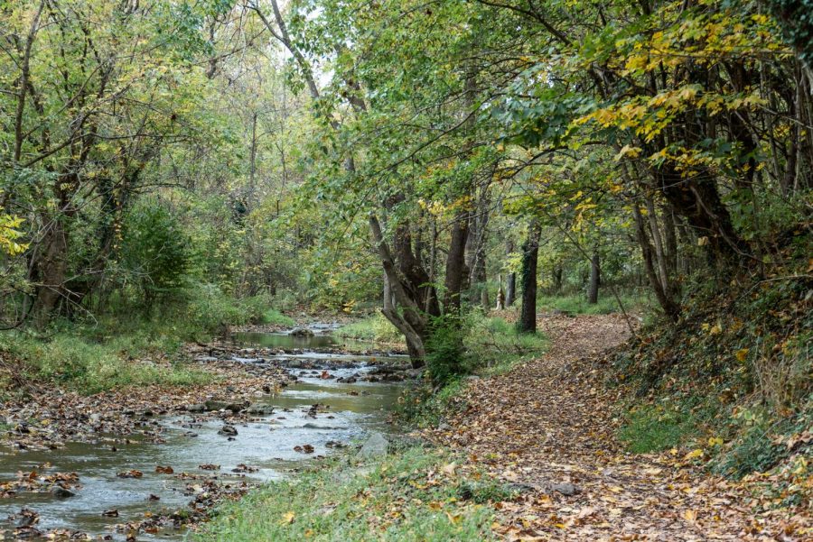
Chilly air and orange leaves have arrived in Lexington, and with the advent of autumn comes a renewed search for fall activities. As the pandemic has swept across the world, Americans across the country have turned to the outdoors for fun, socially distanced engagements. Luckily, our little town has its fair share of possibilities; situated in the Shenandoah Valley, we’re privy to dozens of hikes, each offering breathtaking views of the changing colors in our surrounding landscape. Here are the top three.
Goshen Pass/Chambers Ridge:
Located in Little North Mountain, Goshen Pass is a river gorge carved out by the Maury River and a 25-minute drive from campus. Although mainly used in warmer months for swimming, the protected area has plenty of hiking trails. Take U.S. 11 North out of Lexington towards Walmart and turn left onto Route 39, near the Waffle House. Follow the road for 14 miles and turn right onto a small gravel road. If you end up at the Boy Scout camp on Lake Meriweather, you’ve gone a tenth of a mile too far.
Annie Furr, ‘22, Outing Club key staff member, recommends the Chambers Ridge hike, citing its views of the Maury River and wonderful shock of fall colors. Cross the swinging foot bridge from the parking lot and turn right, following the Maury River. The hike is 0.7 miles and will take about 30 minutes.
Devil’s Marbleyard:
Offering one of the most unique hikes in the Lexington area, Devil’s Marbleyard is a 30-minute drive from campus in Natural Bridge. Parking, located on Petites Gap Road, is limited. Follow U.S. 11 South and turn left onto U.S. 130. Follow the road for 3.4 miles and turn right onto Route 759 before turning left onto Petites Gap Road after 3.5 miles. The parking lot will be 1.5 miles down the road. Follow the Belfast Trail for a mile until you reach the eponymous boulder field and climb as far as you like for evocative views of the valley.
Mount Pleasant:
For one of the largest views in the area, Outing Club key staff Christopher Watt, ‘21, recommends Mount Pleasant, a 45-minute drive from Lexington. The trail is more lightly trafficked than many in the area and is one of Watt’s favorite areas to run. Follow U.S. 60 East towards Buena Vista for 15 miles. Turn left at the general store onto Coffeytown Road. Follow Coffeytown for 1.7 miles before turning right onto Route 755. Follow signs for Mount Pleasant. Route 755 will turn into a dirt road. Continue down the road until you en- counter a fork: bear right and follow the road to the parking area.
Directions courtesy of the Washington and Lee University Outing Club.